Making Space for SaND (MS4S)
The SWCM is one of several partners on the project, which is led by Cornwall Council and includes the University of Plymouth, Cornwall Wildlife Trust and Cornwall Community Flood Forum. The project runs between 2021-2027 and is focused on 40 beach and sand dune locations in Cornwall which provide a key funciton to the community.
About
The aim of the Making Space for Sand Project is to encourage the more sustainable use and development of the coastal fringe to allow for a more natural, ecosystem approach to coastal management where traditional coastal protection is not possible. To learn more about the Flood and Coastal Resilience Innovation Programme and the Making Space for Sand project, please visit the The Project page.


Locations
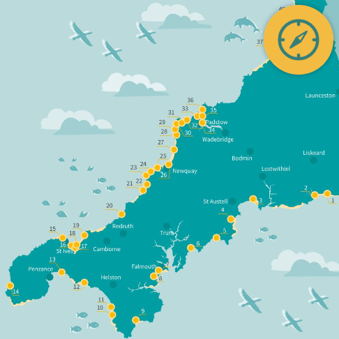
The project has identified 40 locations along the Cornish coast, which may be able to benefit from the project objectives. Data about the health of dune systems and coastal processes will be gathered at all of the locations and this will be used to predict future change. At some of the locations, data collected may identify where action can be taken to help support adaptation and the resilience of the beaches and dune systems to sea level rise and erosion. To learn more about which locations we will be working on please visit the project Locations page.
SWCM Input
The SWCM input to the MS4S project includes:
- Bathymetry - Collection of nearshore bathymetric data from four integral beaches around Cornwall (Mounts Bay, St Ives Bay, Perranporth to Newquay, The Camel Estuary and Bude), with data to be used in sediment volume models.
- CoastSnap - Installing up to 20 CoastSnap stations around the Cornish coast, engaging members of the public to their local or visiting beach and building a image catalogue of a changing coastline.
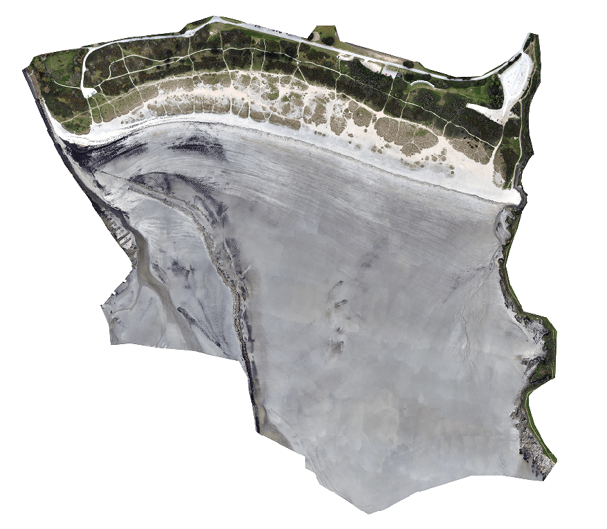
- UAV LiDAR - Collection of repeat, high resolution LiDAR surveys from five key beaches around Cornwall (Bude, Crantock, Gwithian, Marazion, Par) with data to be used in modelling exercises.
- Met Station Installation - A meteorological station was added to the SWCM network through Bude, one of the key data sites whereby wind and rain data is integral to understanding dune dynamics.
- Data Reporting - Analysing all SWCM data from 40 beach and dune locations around Cornwall, and reporting on the current and future state of the dune.

Orthomosaic captured in March 2022 at Par Sands


Let's Keep In Touch
We’ll keep you up-to-date with all the latest news on this website, but we’d also love to be able to send the occasional update.
We promise we'll only use your details to tell you about what we’ve been doing.

