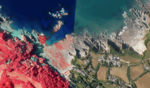
We’re pleased to announce that the fourth set of our aerial orthophotography is now complete and is freely available to download. Orthophotography is aerial photography which has been adjusted for the effects of terrain.
Despite weather conditions limiting our capture schedule, the project team has successfully collected and processed the latest imagery, producing both RGB (Red, Green, Blue) and FCIR (false-colour infrared) orthophotography. This marks an important milestone in our ongoing effort to provide consistent, high-quality coastal data.
Data Capture
Our photography is primarily collected by an aircraft mounted, survey grade, digital camera set to a nadir (bird’s eye) angle to capture the intricacies of the coast.
Each aerial sortie is carried out over the lowest tide, to ensure maximum data capture across the intertidal area. Our imagery covers ~100 m inland, including all tidally influenced estuaries and river channels. The imagery is flown throughout the summer months, when vegetation is at its most abundant, so that it can be used to support our habitat mapping programme.
Why is aerial photography important?
Orthophotography is a powerful resource for understanding and monitoring our ever-changing coastline. By offering both RGB and FCIR datasets, users can access detailed visual records that support a wide range of applications. Repeat aerial photography flights are also highly valuable in illustrating coastal change over time and are frequently used to determine coastal evolutionary trends.
Where can you download the data?
All of our data is freely available to download from the National Network of Regional Coastal Monitoring website – www.coastalmonitoring.org
Look out for our next round of capture commencing 2027!
Let's Keep In Touch
We’ll keep you up-to-date with all the latest news on this website, but we’d also love to be able to send the occasional update.
We promise we'll only use your details to tell you about what we’ve been doing.