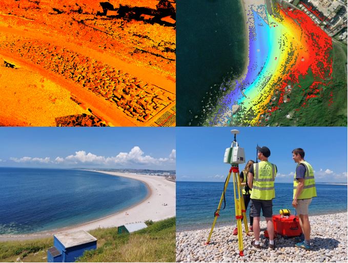
On the 22nd June the SWCM team carried out an annual laser scan on behalf of Bournemouth, Christchurch and Poole Council (BCP). This survey is part of an ongoing elevation monitoring regime of Chesil seawall which started in 2016. We use a Leica C-10 laser scanner to capture the elevation data and Trimble RTK GPS to georectify the survey.
It was carried out at low tide to ensure the whole of the seawall was accessible to scan. The survey comprised of a total of 10 scans, with the laser scanner collecting over 50 million data points, allowing for a 3D point cloud to be generated of the sea wall. This technique provides an accurate, detailed and comprehensive dataset and feeds into the continuous monitoring of the coast by the SWCM.
Let's Keep In Touch
We’ll keep you up-to-date with all the latest news on this website, but we’d also love to be able to send the occasional update.
We promise we'll only use your details to tell you about what we’ve been doing.