Education
Why is it so important for children to learn about coastal processes?
Engaging with school children is incredibly important in order to impart knowledge about our coastlines early on. The dynamic nature of our coasts, influenced by storms and rising sea levels, underlines the urgency of educating them. We are committed to this, offering a range of easily downloadable resources tailored for Key Stage 3, GCSE, and A Levels. These comprehensive packs empower teachers helping them educate children about the dynamic processes shaping our local beaches.

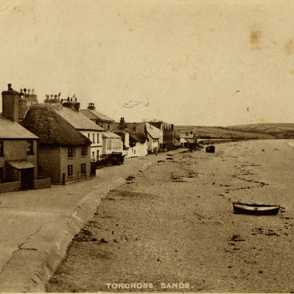
1907
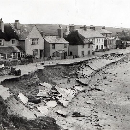
1951
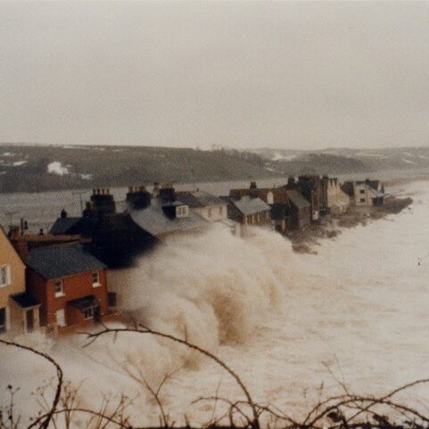
1980s
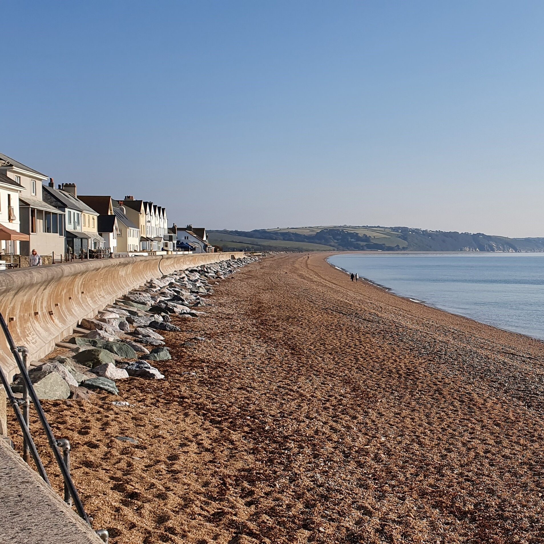
2021
Torcross, South Devon through the years. Photos courtesy of The Cookworthy Museum.
SWCM Resources
Key Stage 3: The Dynamic Coast
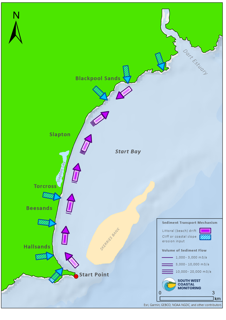
Work Package
In collaboration with Geography Southwest.
Includes:
- 4x PowerPoints:
- Where is Start Bay?
- The 'lost village' of Start Bay
- Can Torcross be defended from the sea?
- Start Bay: Dynamic sediment cell - 4x Worksheets
- 1x OS Map Skills Worksheet

GCSE: Southwest Case Studies
Case studies looking at a range of different methods of monitoring, help explain the swath of coastal
processes occurring around the Southwest (2007 - 2024):
Take a look at the active sand spit at Dawlish Warren (South Devon), which is influenced by various coastal processes, resulting in a drastic change in size and shape.
Aerial photography is one of our primary data sets, it is a vital resource for capturing landslides and rockfalls, which regularly occur at Pennington Point, Dorset.
Start Bay is a prime candidate for bimodal beach rotation. Discover how energetic storms from 2013/2014 impacted the beach at Slapton Sands, Devon.
Understand how a small river outlet can have underpinning impacts on the nearby coast at Seaton, Cornwall.
See how allowing natural processes to dominate over human intervention can impact coastal areas such as Porlock Bay, Somerset.
The Bristol Channel produces some of the largest tidal ranges in the world. Take a look at the different survey methods we use to survey Berrow Dunes, Somerset.
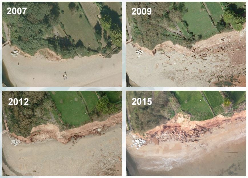
Cliff recession between 2007, 2009, 2012 and 2015 at Sidmouth, South Devon
CreamT Resources
Coastal REsistance: Alerts and Monitoring Technologies (CreamT)
A 1 m sea level rise is almost certain in the next century and it is estimated that 20% of England’s coastal defences could fail under just half this rise. The CreamT project looked to find better ways to measure, forecast, warn of and respond to coastal flooding. Using Penzance and Dawlish we will demonstrate a new monitoring system able to issue vital real-time hazard alerts and flood data to national government agencies.
Case Study: Dawlish, South Devon
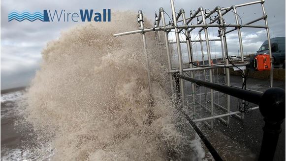
Along sea walls, across the UK, waves can overtop, sending fast jets of water and spray inland. This poses a hazard to people, transport and property. Coastal forecasts are used to predict when conditions might be hazardous to close access routes and close flood barriers. This project focuses on gathering information about hazardous coastal conditions in the southwest to understand waves, water levels, beach levels and wind.
- KS3 - Investigating Waves at Dawlish : a GIS Activity
- GCSE - Dawlish: Coastal Processes, Hazards and Management
- A Level - Coastal Hazard Forecasting and Monitoring in the Southwest of England
Activities and Worksheets:
In association with the following organisations:




Let's Keep In Touch
We’ll keep you up-to-date with all the latest news on this website, but we’d also love to be able to send the occasional update.
We promise we'll only use your details to tell you about what we’ve been doing.
